22 June, 2010

New7Wonders of Nature [Puerto Princesa Underground River]

The Puerto Princesa Subterranean River National Park is located about 50 km north of the city of Puerto Princesa, Palawan, Philippines. It features a limestone karst mountain landscape with an 8.2 km. navigable underground river. A distinguishing feature of the river is that it winds through a cave before flowing directly into the South China Sea. It includes major formations of stalactites and stalagmites, and several large chambers. The lower portion of the river is subject to tidal influences. The underground river is reputed to be the world's longest. At the mouth of the cave, a clear lagoon is framed by ancient trees growing right to the water's edge. Monkeys, large monitor lizards, and squirrels find their niche on the beach near the cave.

21 June, 2010

New7Wonders of Nature [Bay of Fundy]

The Bay of Fundy (French: Baie de Fundy) is a bay on the Atlantic coast of North America, on the northeast end of the Gulf of Maine between the Canadian provinces of New Brunswick and Nova Scotia, with a small portion touching the U.S. state of Maine. Some sources believe the name "Fundy" is a corruption of the French word "Fendu", meaning "split",[1] while others believe it comes from the Portuguese fondo, meaning "funnel". The bay was also named Baie Française (French Bay) by explorer/cartographer Samuel de Champlain during a 1604 expedition led by Pierre Dugua, Sieur de Monts which resulted in a failed settlement attempt on St. Croix Island.
The Bay of Fundy is known for its high tidal range. Rivaled by Ungava Bay in northern Quebec and the Severn Estuary in the UK, it has one of the highest vertical tidal ranges in the world.
Portions of the Bay of Fundy, Shepody Bay and Minas Basin, form one of six Canadian sites in the Western Hemisphere Shorebird Reserve Network, and is classified as a Hemispheric site. It is owned by the provinces of New Brunswick and Nova Scotia, and the Canadian Wildlife Service, and is managed in conjunction with Ducks Unlimited Canada and the Nature Conservancy of Canada.
In July 2009, the Bay of Fundy was named as a finalist for the New 7 Wonders of Nature.

New7Wonders of Nature [Black Forest]

Hello in the Black Forest!

Welcome to blackforestinfo.com! In these pages you will find information and stories around the Black Forest, the most popular German holiday destination - compiled and processed by an experienced editorial staff which follows the strict rules of journalistic writings - independent from any influences from outside.

What does blackforestinfo.com offer you?

Informationen über Landschaften im SchwarzwaldWe want to present that part of the Black Forest in the internet which might be of any interest to tourists. We offer the most beautiful hiking tours, the best recipes, history and stories, things to do, the most interesting tours by car and the trains in the Black Forest - you will find everything you need to plan your vacation - even if it is only a stay over the weekend. Moreover you will find information on ski resorts including information on ski lifts, runs and cross country trails.
Enjoy yourself!

New7Wonders of Nature [Angel Falls]

Angel Falls or Kerepakupai merú (which means "waterfall of the deepest place", in Pemon language, or: Parakupa-vena, which means "the fall from the highest point"; Spanish: Salto Ángel) is a waterfall in Venezuela.
It is the world's highest waterfall, with a height of 1,054 m (3,458 ft) and a plunge of 807 m (2,648 ft). The waterfall drops over the edge of the AuyantepuiCanaima National Park (Spanish: Parque Nacional Canaima), a UNESCO World Heritage site in the Gran Sabana region of Bolívar State, Venezuela. mountain in the
The height of the fall is so great that before getting anywhere near the ground, much of the water is evaporated or carried away as a fine mist by the strong wind. The base of the falls feeds into the Kerep River (alternatively known as the Río Gauya), which flows into the Churun River, a tributary of the Carrao River.
The height figure 3,212 ft (979 m) mostly consists of the main plunge but also includes about 0.25 mi (400 m) of sloped cascades and rapids below the drop and a 100-foot (30 m) high plunge downstream of the talus rapids. While the main plunge is undoubtedly the highest single drop in the world, some feel that including the lower cascades somewhat stretches the criteria for the measurement of waterfalls, although there are no universally recognized standards of waterfall measurement.

New7Wonders of Nature [Dead Sea]

The Dead Sea (Arabic: البَحْر المَيّت‎, al-Baḥr El-Mayyit, Hebrew: יָם הַ‏‏מֶּ‏‏לַ‏ח‎, Yām Ha-Melaḥ; "Dead Sea" , "Sea of Salt"), also called the Salt Sea, is a salt lake bordering Israel and the West Bank to the west, and Jordan to the east. Its surface and shores are 422 metres (1,385 ft) below sea level,[2] the lowest elevation on the Earth's surface on dry land. The Dead Sea is 378 m (1,240 ft) deep, the deepest hypersaline lake in the world. It is also one of the world's saltiest bodies of water, with 33.7% salinity. Only Lake Assal (Djibouti), Garabogazköl and some hypersaline lakes of the McMurdo Dry Valleys in Antarctica (such as Don Juan Pond) have a higher salinity. It is 8.6 times more salty than the ocean. This salinity makes for a harsh environment where animals cannot flourish, hence its name. The Dead Sea is 67 kilometres (42 mi) long and 18 kilometres (11 mi) wide at its widest point. It lies in the Jordan Rift Valley, and its main tributary is the Jordan River.
The Dead Sea has attracted visitors from around the Mediterranean basin for thousands of years. Biblically, it was a place of refuge for King David. It was one of the world's first health resorts (for Herod the Great), and it has been the supplier of a wide variety of products, from balms for Egyptian mummification to potash for fertilizers. People also use the salt and the minerals from the Dead Sea to create cosmetics and herbal sachets.
The sea has a density of 1.24kg/L, making swimming difficult.

New7Wonders of Nature [Amazon]

The Amazon Rainforest, also known as Amazonia, the Amazon jungle or the Amazon Basin, encompasses seven million square kilometers (1.7 billion acres), though the forest itself occupies some 5.5 million square kilometers (1.4 billion acres), located within nine nations. The Amazon represents over half of the planet's remaining rainforests and comprises the largest and most species-rich tract of tropical rainforest in the world. The Amazon River is the largest river in the world by volume, with a total flow greater than the top ten rivers worldwide combined. It accounts for approximately one-fifth of the total world river flow and has the biggest drainage basin on the planet. Not a single bridge crosses the Amazon.

19 June, 2010

where you'll be lost in amazing beauty of nature


Tanguar Haor a large haor lies within Sunamganj district extending over 10 mauzas of Dharmapasha and Tahirpur upazilas of the district. The mauzas covering the Tanguar haor are (1) Jagadishpur, (2) Bhabanipur, (3) Lamagaon, (4) Ramsinhapur, (5) Mahajampur, (6) Maindag, (7) Mayajuri, (8) Bhangachara Purba, (9) Noagaon, and (10) Tanguar Haor. The haor consists of 120 beels of various sizes. The area of Tanguar haor including 46 villages within the haor is about 100 sq km of which 2802.36 ha is wetland.
The haor is an ideal place for the migratory birds. Every winter about 200 types of migratory birds come to this haor and make their temporary habitat here. Once upon a time the zamindars of Sunamganj area used to make cruise into this haor with large Pansi boats for hunting birds.
The haor is an important source of fisheries. More than 140 species of fresh water fishes are available here. Among them the notables are Air, Gang Magur, Baim, Tara Baim, Gutum, Gulsha, Tengra, Titna, Garia, Beti, Kakia etc. In the 1999-2000 fiscal year, government earned Tk 70,73,184 as revenue only from fisheries of the haor.
Hijal (Barringtonia acutangula), Karach (Pongamia pinnata), Gulli, Balua, Ban Tulsi (Ocimum americanum), Nalkhagra (Phragmites karka) and some other important threatened species of freshwater wetland trees are available in this haor.
Most of the inhabitants of the Tanguar haor are landless or marginal farmer. As the haor allows single crop throughout a year, seasonal unemployment problem is very acute here. But the farmers harvest high yield because of the richness of the soil though the lands are single cropped.
The haor is cyclone prone as it located at the foothills of the Khasi-Jaintia Hills and a number of hailstorms also occur. Therefore at times crops get damaged. Except the levee or the kanda areas of the haor the other lands of the haor are used as pastureland. In the past the levees were deeply covered with trees. But afterwards the areas were deforested widely to meet the demand of additional lands for settlement and cultivation, which caused environmental degradation, and loss of biodiversity of the haor.
In the past few decades the total environmental settings of the Tanguar haor has degraded a lot. In consideration of its environmental importance and heritage, the government has decided to save the large haor by symbolizing it as an internationally critical environment area and listed the haor as a 'Ramsar area' under Ramsar Convention. In accordance with this, the government has taken massive plan to restore the natural environment and heritage of the Tanguar haor by conserving its water, improving agriculture and fish production, and making the haor secured zone for birds and animals. The government has also decided not to allow any developmental or commercial activity within the haor area that is harmful for the sensitive environment of the haor. Besides these, the government has banned on digging any well for gas or oil within the 10 km area of the haor. The natural beauty of the Tanguar haor attracts the tourists and the haor can be turned as an important tourist place.

11 June, 2010

Collaborative Management of Tanguar Haor

Vision and Goal

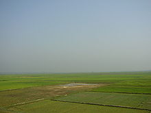
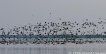
Establishment of a co-management system for natural resources in the entire Tanguar Haor, which ensures the sustainable use of the resource base while maintaining community livelihoods in a way that is sensitive to Ramsar values.
Approaches

Co-management approach
Ecosystem based approach
Livelihood approach
Human and Institutional approach
Market approach
Objectives

Selected communities of Tanguar Haor have the capacity and the organisation to participate in pilot co-management activities.
An institutional system is negotiated and piloted to support towards development of fully operational co-management system for Tanguar Haor.
The knowledge on Tanguar haor is organised to provide necessary inputs for the development phase.
A cost recovery mechanism is developed and put in function.

Main activities

Community mobilization towards co-management of Tanguar Haor
Development and testing modalities of a co-management system
Selection and skill development for alternative livelihoods strategies
Knowledge management system development
Achievements
The project started in early 2007. The first phase of the project aims at collecting information, testing activities in the field of collaborative management and alternative livelihoods development.
A project support management unit is established in Sunamganj district head quarter in first quarter of 2007.
Sharing and consultative workshops were organised at upazilla level and attended by at least one representative from each village (88 Villages) in two upazillas. GoB high officials, local government representatives, officials from IUCN, IC and all PNGOs also participated. Such events contribute to document peoples' aspiration and traditional knowledge on organisational structure and resource protection strategies of Tanguar Haor. Thirty communities were selected for piloting through a consultative process (consultation with the community representatives, upazilla administration and local government bodies ).
The Ministry of Environment and Forest approved the project and assigned a joint secretary as national project director.
A Steering Committee (SC) at national level and a Tanguar Haor Management Committee (THMC) at district level were formed. Two THMC meetings were organised in April and May.
Budget


USD 0.65 million (October 2006 - April 2009)


Hakaluki haor

Hakaluki Haor is a marsh wetland ecological system of Eastern Bangladesh in an area bordering Assam, India[1]. It is one of Bangladesh's largest and one of Asia's larger marsh wetland resources. Some 190,000 people live in the surrounding Hakaluki haor area[2].
Hakaluki Haor was designated an Ecologically Critical Area (ECA) by the Director General of the Department of Environment, as the ecosystem is considered to have reached a critical state. It also is a protected Ramsar site[3] of international importance for the conservation and sustainable utilization of wetlands.
The surface area of Hakaluki Haor is 181.15km2, of which 72.46km2 (40.01%) is within the territory of Barlekha Upazila. The haor is partly under the jurisdiction of Barlekha Upazila.
Hakaluki Hawor Sylhet Bangladesh 46.JPG
hakaluki haor

07 April, 2010

About haor

Haor bowl-shaped large tectonic DEPRESSION. It receives surface runoff water by rivers and khals, and consequently, a haor becomes very extensive water body in the monsoon and dries up mostly in the post-monsoon period. In Bangladesh haors are found mainly in greater Sylhet and greater Mymensingh regions. During monsoon a haor is a vast stretch of turbulent water. The word haor is a corrupt form of the Sanskrit word Sagar (SEA). In Sylhet and northeast Mymensingh, the people pronounce the Bangla letter ৸স৹ (sa) as ৸হ৹ (ha), and some times ৸গ৹ (ga) as ৸হ৹ (ha). Thus sagar is sounded haor.
The haors are of tectonic origin and possibly connected with the rise of MADHUPUR TRACT. BEELs do not subside but haor basins do. In its original form, the haor basin comprising the FLOODPLAINs of the MEGHNA tributaries would have consisted of a rich mosaic of permanent and seasonal lakes and ponds with abundant aquatic vegetation. But through gradual sedimentation, the basin becomes shallower leading to the formation of reeds and sedges. This resulted in providing enough food and shelter for FISH and other aquatic, fauna and attracted the MIGRATORY BIRDs which, in their turn, added to the fertility of the waterbodies by their excreta promoting rich growth of phytoplankton and macrophytes thus partly contributing to the process of eutrophication.
The haor basin is bounded by the hill ranges of Meghalaya (India) on the north, the hills of Tripura and Mizoram (India) on the south, and the highlands of Manipur (India) on the east. The basin includes about 47 major haors and some 6,300 beels of varying size, out of which about 3,500 are permanent and 2,800 are seasonal. Numerous rivers rising in the hills of India provide an abundant supply of water to the plains and cause extensive flooding during the monsoon upto a depth of 6m. Small permanent water bodies within the haors are called beels, which occupy the lowest part of the depressions. During the dry season, most of the water drains out leaving one or more shallow beels which become mostly overgrown with aquatic vegetation or completely dry out by the end of dry season exposing rich ALLUVIAL SOILs extensively cultivated for rice.
The SURMA and KUSHIYARA in association with other minor hilly STREAMs like MANU, KHOWAI, Jadhukata, PIYAIN, Mogra and Mahadao form the dense drainage network of the haors. The rivers are primarily responsible for providing inputs - rainwater and sediment load to the plains including haors. The plains remain flooded for about 7 to 8 months. During the rainy season, the haors turn into a vast inland sea within which the villages appear as islands. Occasional high winds during July to September generate large waves in the haor, which may cause considerable damage to homesteads.
The entire Sunamganj district, major portion of Habiganj district, some parts of Sylhet Sadar upazila and Maulvi Bazar district are covered by many haors. In greater Sylhet the most prominent haors are Saneer haor, Hail haor, Hakaluki haor, Dekar haor, Maker haor, Chayer haor, TANGUAR HAOR, and Kawadighi haor.
The haors are considered the most productive WETLAND resources of Bangladesh. The basin supports a large variety of wetland bio-diversity and works as natural reservoir as it plays a key role in basin water resources by regulating water flows of the Meghna river system. Also, the haors are noted sanctuaries of both permanent and migratory birds. With the recession of floodwater, a large variety of small fishes, oysters, water snails and bivalves, and pasture spread over the surface attracting a large number of migratory birds. These BIRDs use the haor as temporary resting and roosting ground before moving elsewhere. The SWAMP forests, which were once dominant with the FLOOD tolerant tree species like HIJAL (Barringtonia acutangula) and Koroch (Pongamia pinnata), have been reduced to a few small patches. The haors are also important fishing grounds of the country. In the past century or so, when the population pressure was less, most of the rim-lands of the haors remained as cultivable wasteland and was used for extensive grazing in the dry season. As population increased, boro cultivation expanded onto these marginal lands leading to a large area being drained. Thus, the very existences of these wetlands are now threatened.

06 August, 2009

beautiful scenery of tangoar haor


Introduction:

Tanguar Haor, located in the district of Sunamganj in the north-eastern part of Bangladesh, is a unique wetland ecosystem of national and international importance covering about 10,000 hectares. It provides subsistence and livelihoods to more then 40,000 people living in 46 villages situated in its periphery. The Government has declared Tanguar Haor as an Ecologically Critical Area (ECA) in 1999 understanding its critical condition due to overexploitation of natural resource. In 2000, the Hoar basin was also declared as the country's second Ramsar site-wetland of international importance. With this declaration, the Government of Bangladesh is committed to preserve its natural resources and have taken several steps for protection of this wetland. The Tanguar Haor plays an important role in fish production as it functions as a 'mother fishery' for the country.

Poverty:

It is estimated that more than 40 percent of the population regularly consume less than the absolute critical minimum of 1800 kilocalories per day. These 50 million people are amongst the poorest in the world by any standard of development. Furthermore, it has been estimated that the number of absolute poor has risen significantly. The poverty of these deprived people is deep rooted, pervasive and multi-faceted, relating not just to the absence of reliable incomes and productive assets, but also to food, safe water, sanitation, education, shelter, inequities, injustice and lack of power. These deprived people are also extremely vulnerable to disaster and disease. The challenges posed by this massive poverty are enormous for a country with accelerating environmental degradation of an overpopulated land base. The human development indicators for Bangladesh are also staggeringly low. Bangladesh has an adult literacy rate of 37 percent, life expectancy of 58 years and population below poverty level of 45 percent. Urban slum dwellers now account for some 15 percent of the population and this is still growing by 6 percent per year.